Posted on June 9, 2021 in Drone integration and UAV LiDAR
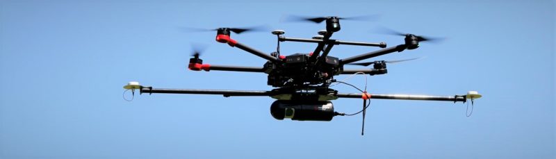
Routescene drone LiDAR System in flight
We recognize that every customer has their own preferences for the Unmanned Aerial Vehicle (UAV) they like to use. Payload, flight performance (duration and speed), fuel type, type of drone (multicopter, Vertical Take Off and Landing or fixed wing) and whether you need Beyond Visual Line of Sight (BVLOS) operations should all be considered when selecting a drone. Here are our tips for choosing a drone to fly your UAV LiDAR system:
1. Payload
The weight of your payload is directly correlated to the size of drone you will need and the flying time you will achieve. Routescene® UAV LiDAR Systems can fly on any aerial platform that can carry a payload of between 2.0kg (4.4llbs) and 2.4kg (5.3lbs) depending on the options you select. The total weight of the system includes the LidarPod plus all the peripherals such as the UAV mounting kit, cables and GNSS antennas.
2. Flight performance
Flight time and speed are key considerations and impact on the efficiency of your survey and the end results.
2.1 Flight duration
The duration of your drone flight time has a direct impact on the efficiency of your survey. With short duration drones (15-20min) the number of flights and take-off and landings you need to do to cover a survey area will be much more than with a long endurance drone (3hrs), such as the Perimeter 8 from Skyfront. A 3 hour long endurance drone flying at 5m/s will enable you to survey 54 line kilometers in one flight. To achieve this distance with a 15-20min short duration drone will require 11 flights, which will take you roughly 2 days to complete.
The Routescene LidarPod is designed for long endurance. It has a 12 hours data storage capacity, low power consumption and the telemetry system can, under the right conditions and setup, achieve a range of 10km.
See our article on how we tested the flight time of the Skyfront drone carrying Routescene’s UAV LiDAR System at Skyfront’s test site in California.
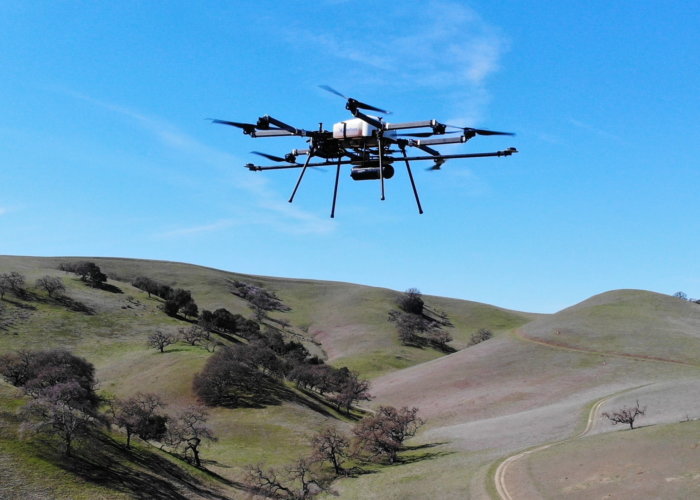
Skyfront Perimeter 8 drone carrying Routescene RS4 UAV LiDAR System
2.2 Flying speed
The flying speed of the UAV will greatly impact the resolution and the quality of the final results. The slower you fly the higher the resolution of the point cloud as you achieve greater overlap between individual scans. The flying speed is dependent on your application, if you need to penetrate foliage you will want to fly slower. The nominal flying speed that we recommend to achieve a very good data density and vegetation penetration is 5-7m/s. We have collected data using a fixed wing mapping drone at 20m/s with reasonable results, however we suggest that 15m/s is the maximum speed to ensure the data resolution and quality is not compromised too much.
3. Fuel
The type of energy or fuel used to power the mapping drone is important, especially if you undertake projects overseas or need to airfreight your drone.
3.1 Battery powered drones
The main type of energy used to power a drone is electrical power normally supplied using Lithium Polymer (Li-Po) batteries. These batteries have a high energy density and a high power density and are ideal for UAV drone use. This is because drones need batteries that will provide high power to the props during take-off and yet the batteries need to be as light as possible to increase the UAV’s endurance. The downside with these batteries is that they are difficult to transport by air in sufficient quantities to undertake a project efficiently as they are classified as dangerous goods. You also need to consider how you will re-charge batteries in the field, either using a generator or battery power pack.
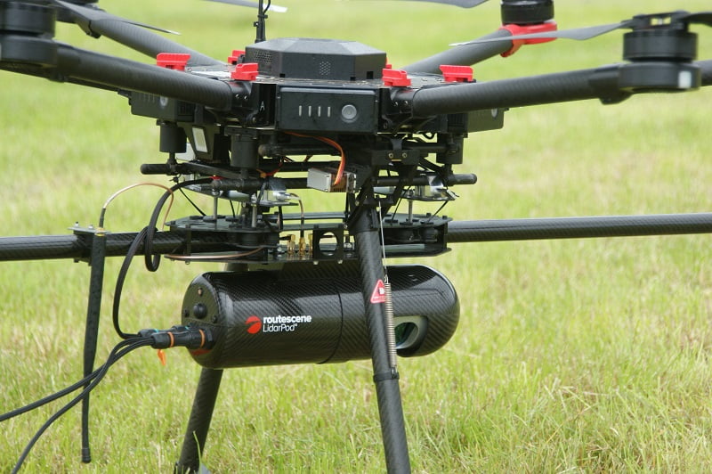
Routescene UAV LiDAR System mounted onto a battery powered drone
3.2 Hybrid – gas/ electric drones
Hybrid power sources are becoming more common. For example, the Skyfront Perimeter 8 drone uses a gas (petrol) powered generator to create electrical energy, which powers the props. The power source has a very high energy density which enables the UAV to have a long duration. The fuel is readily available around the world making logistics a lot easier. The disadvantage is that the maintenance regime is more onerous and complex.
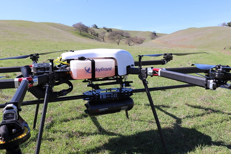
Skyfront Perimeter 8 drone with Routescene LidarPod mounted underneath
3.3 Hydrogen fuel cell powered drones
Hydrogen fuel cells are being investigated and there are a few on the market. The fuel is renewable and environmentally friendly only emitting water and air as by products. The energy density of a hydrogen fuel cell is significant and can be up to 150 times that of a Li-PO battery.
Hydrogen fuel cells are much heavier and larger than Li-Po batteries so this type of energy source is restricted to the larger UAVs. This means the Maximum Take Off Weight (MTOW) of the UAV may fall in a higher class of drone. This potentially results in more certification and qualifications being required and it might limit the areas or countries the UAV is allowed to fly in. The availability of and ability to transport this fuel type across the globe might be a factor to consider, particularly because this energy source is not widely available.
Note:
Power density = the amount of power the source can provide in an instance.
Energy density = the amount of energy that can be stored in the power source.
Read this review of energy sources for UAV for more information.
4. Unmanned/ Uncrewed Aerial System (UAS) type
The type of UAS to use for your project, whether it be multi-copter, VTOL, helicopter or fixed wing, is important. This decision will impact on the duration you will achieve, the practicality of take-off and landing, flying altitude and the minimum airspeed. These factors in turn influence the ability of your LiDAR system to penetrate vegetation effectively and the quality of the end result. Put simply, the higher and faster the UAS flies, the lower the ability of the LiDAR system to penetrate vegetation effectively. The accuracy of the end results are also proportional to the flying height: the higher you fly above your survey site the lower the accuracy.
4.1 Multicopter drones
The most popular UAS type for LiDAR surveys is the multicopter. These drones can fly slowly; they do not need a high safety margin, as the pilot has a high level of control, and they can quickly climb if you encounter an obstacle. This maneuverability means they can fly relatively low over the area of interest and can take-off vertically in a small clearing. Additionally, they are low maintenance. There are numerous commercial multicopters on the market that can carry the LidarPod and, depending on the model, offer a wide endurance range from 15min to 3hours. These versatile systems can be utilized for a variety of different payloads and projects and the entry level models are a low capital expenditure.
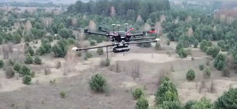
Routescene LidarPod flying over forests at Chernobyl on a multicopter drone
4.2 Vertical Take Off and Landing (VTOL) drones
VTOL UAS are increasing in popularity as they provide the best of two worlds: firstly, vertical take-off from small clearings and secondly, aerodynamic flight. Aerodynamic flight is achieved when the drone is in “airplane” mode. It uses its’ wings to create lift, enabling the VTOL UAV to fly much longer missions than multicopters for the same amount of energy. VTOL drones are generally larger than multicopters; they have a dedicated payload bay which needs to be streamlined to minimize drag. A VTOL will fly much faster than a multicopter, typically 15m/s. This means that the point density that can be achieved during a LiDAR survey will be lower. Flying speed also affects the flying altitude required above a survey site; the higher the speed the higher the required altitude. This is to allow a larger safety margin in altitude to ensure there is sufficient reaction time to avoid any unexpected objects in its’ flight path such as tall trees. Again, this will impact the data density and the accuracy of the final results.
4.3 Helicopters
Helicopters are increasing in popularity for long range and Beyond Visual Line of Sight (BVLOS) operations. This is due to their payload capacity, which typically is much higher than multi-copters and VTOL, and their endurance is longer. Their ability to take-off from small areas, hover and move at slow speed means helicopters are more agile than VTOL aircraft. The helicopter is ideally suited for LiDAR survey operations, particularly those where long range is required, for example for long transmission line inspection projects.
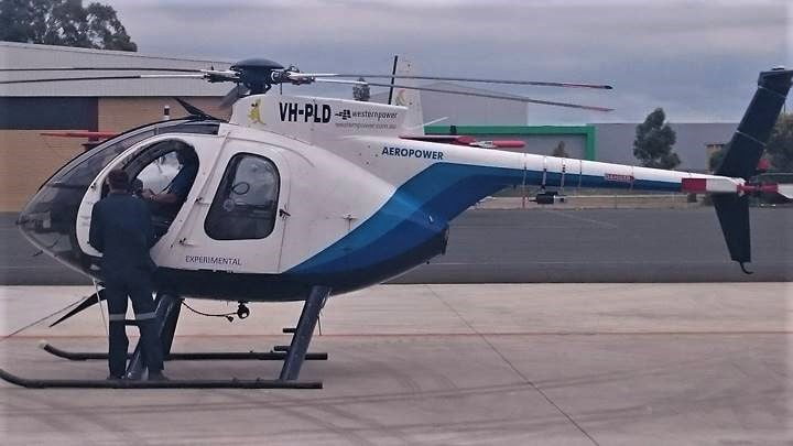
Hughes 500 Helicopter with Routescene LidarPod mounted onto the tail
However, the helicopter is a much more complex machine and is more expensive to maintain, service and operate. The skill level required to fly a helicopter is much higher than for a multi-copter or fixed wing mapping drone, requiring a skilled and specialist pilot. Helicopters suffer from a high degree of vibration so it is important to design a mounting bracket that significantly dampens this movement. This will ensure the noise does not interfere with the GNSS/INS which is a sensitive instrument recording acceleration in all 3 axes.
4.4 Fixed wing Unmanned Aircraft System (UAS)
The fixed wing drone is predominantly used for photogrammetry purposes. The current trend is for Delta wing aircraft which are small, can carry a light single camera payload and have an endurance of up to an hour. These fixed wing aircraft are hand launched and require a small strip to land on. This type of aircraft is not suitable for LiDAR surveys as they are not capable of carrying the LiDAR system payload. More suitable fixed wing aircraft are on the market but they tend to be bigger, typically with a 3m wingspan. These UAVs are launched by catapult and require a grass or hard surface to land on. The payload of larger fixed wing aircraft is significant enabling them to carry multiple sensors on one mission and have an endurance of several hours. This long endurance means they can be a very cost effective solution when you need to survey a large area.
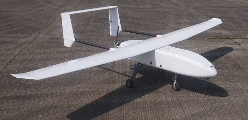
Hanseatic-S360 Mk II fixed wing drone
A payload for a geophysical survey might include a color camera, LiDAR system and magnetometer. Collecting all this time-synchronized data in one mission has many advantages. The flying speed and altitude of a fixed wing UAV tend to be around 20m/s which is relatively fast and so the point density will not be very high. The flying altitude will also be higher for safety reasons, reducing the accuracy of the final result.
5. Beyond Visual Line of Sight (BVLOS)
The UAV industry is working towards longer endurance and BVLOS operations. BVLOS enables the UAV to fly beyond the visual sight of the pilot, a legal requirement enforced by the Civil Aviation Authority of a country. BVLOS flying requires more onerous operational procedures. To start, you need to apply for a waiver for each sortie. You are required to employ a method to detect other aircraft in the vicinity, other than visual (eyeball) means. A longer range telemetry system is needed to ensure reliable communications and at the moment the areas where BVLOS is permitted are limited. With ever more sophisticated systems, sensors and procedures, refined over many years since UAVs first came onto the market, BVLOS permissions are now easier to obtain and execute.
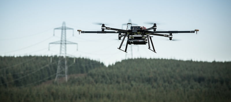
Future Beyond Visual Line of Sight certification will have many applications such as vegetation encroachment surveys along powerlines
There is a great deal of BVLOS research and testing currently being undertaken. Indeed, the global COVID-19 pandemic has accelerated this development as the technology reduces the need for people to be physically on site, reducing the chance of transmission. For example, removing movement in and out of remote regions, eliminating the need for a presence at installations such as oil rigs or moored container ships.
BVLOS operations are a significant benefit for LiDAR surveys as a much larger area can be surveyed in one mission. For example, the number of power line kilometers that can be inspected and surveyed in one flight will greatly increase, making the BVLOS drone a more attractive and cost effective platform compared to the manned helicopter, which has a much higher operating cost. BVLOS operations also mean that the physical and legal challenges of flying over trees, where your visual line of sight to your drone quickly disappears, are immediately resolved.
Summary
There are many factors to consider when deciding which type of drone to combine with your LiDAR surveying and mapping equipment. The primary consideration is the ability of the drone to lift the weight of the LiDAR equipment comfortably and fly for a required amount of time (this does depend on your application).
Which neatly segways us into your application… this will inform the accuracy and density of the point clouds you need. To gain denser and more accurate point clouds the lower and slower the drone can fly the better. If you also need to penetrate through vegetation this further impacts, again the lower and slower you can fly the better. Today we tend to see the larger lift multicopters being used with Routescene LiDAR mapping drone systems.
Then you will need to think about the power source, how long flight times will be and how many times you will have to take off and land whilst surveying the area. Again these these are all influenced by your application.
Legislation is different in different countries and, along with the technology, continues to change at a pace. In the near future we expect to see applications such as vegetation clearance for power lines being carried out by long-endurance drones operating Beyond Visual Line of Sight (BVLOS). This change of legislation will make drone operations commercially viable for many projects. It will bring exciting opportunities for a wide range of industries to use drones in ways they have not been used before.