LiDAR technology and its’ use for archaeological survey in the mining industry
Posted on November 24, 2017 in News

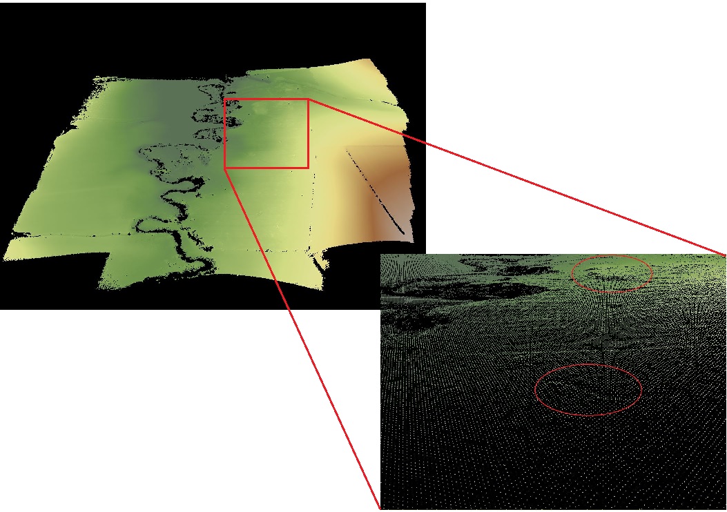
Bare earth point cloud (left) with a detailed extract highlighting potential artefacts (right)
Today at Routescene we decided to explore the exciting ways that LiDAR technology is revolutionizing site surveys in the mining industry. We have looked at archaeological reconnaissance and how bare earth modelling enables in-depth artefact assessment that previously was difficult or impossible to undertake.
What is LiDAR?
LiDAR, which stands for Light Detection and Ranging, is a laser-based technology. It is a non-intrusive, remote sensing method used to examine the surface of the Earth and obtain detailed and precise geo-referenced datasets. LiDAR, particularly using Unmanned Aerial Vehicles (UAVs) or drones, is a superior tool for densely vegetated sites or those where physical access to the land is limited, hazardous or otherwise too costly to access.
The advantages of LiDAR over photogrammetry in archaeological reconnaissance
Before the advent of LiDAR, heavily vegetated or forested cover prevented the full coverage and documentation of many archaeological sites and reconnaissance projects as photogrammetric survey methods are unable to penetrate beyond the vegetation or tree canopy.
The benefit of LiDAR is that we not only capture data on the tree canopy itself but also the lasers penetrate the vegetation layers below including branches, foliage, lower level shrubs with a proportion of the points reaching the ground itself. In addition, LiDAR is not dependent on light conditions and is not impacted by shadows or poor light, which is a real and frequent problem with photogrammetry.
Using Drone or UAV based LiDAR to optimize archaeological survey on mine sites
Drone based LiDAR offers huge potential to optimize the archaeological reconnaissance and survey process in the mine planning stage. During archaeological reconnaissance projects data is required across a range of scales from the highly minute of individual objects to distributions of cultural materials across entire landscapes. Cultural artefacts are often extended across large spatial areas, sometimes made more complicated with vegetation and tree coverage. Such data collection on the landscape scale has previously been time consuming and expensive.
Flying LiDAR on drones requires significantly less time and resources, has hugely reduced the cost of such projects and improved productivity enabling results to be viewed nearly instantaneously.
As well as optimizing the data collection and business efficiencies, UAV LiDAR is another way to preserve archaeological sites. Remote-sensing methods help researchers to comply with “conservation ethic” and make sure that any potential damage to historic sites is minimized.
Bare earth modelling to assess results quickly
Bare earth modelling using LiDAR data is an analytical tool which enables an in-depth assessment of terrain. LiDAR data offers the unique ability to remove all non-ground points and reveal what’s on the ground surface. Essentially, bare modelling is a very quick way to evaluate the site and identify where artefacts might be located on the ground.
This tool can be applied to the captured dataset post-survey without the analyst having to visit the actual site, saving time and money.
